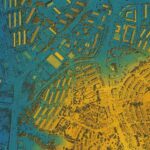

In the age of rapid urbanization and industrialization, the preservation of our planet’s natural resources has become more critical than ever. Environmental conservation requires comprehensive understanding, effective planning, and strategic decision-making to ensure the sustainable management of ecosystems and biodiversity. One indispensable tool in this endeavor is Geographic Information Systems (GIS), which plays a pivotal role in mapping, analyzing, and protecting our environment.
You may also like: “Top 5 Features to Look for in a GIS Mapping Service Provider”
GIS technology enables the integration of spatial data, such as maps, satellite imagery, and environmental datasets, to visualize and analyze complex relationships between natural systems and human activities. By harnessing the power of GIS, conservationists can assess habitat fragmentation, monitor deforestation, track wildlife populations, and identify areas of ecological significance. This spatial analysis provides invaluable insights for informed decision-making and targeted conservation interventions.
One of the key applications of GIS in environmental conservation is habitat mapping and
biodiversity assessment. By overlaying habitat data with land use, climate, and terrain
information, conservationists can identify critical habitats, corridors for wildlife migration, and areas in need of protection. This data-driven approach facilitates the design and
implementation of conservation strategies that prioritize the preservation of biodiversity
hotspots and endangered species habitats.
GIS also plays a vital role in natural resource management, including water resources,
forests, and agricultural land. By analyzing spatial patterns and trends, GIS helps identify
areas at risk of degradation or depletion, enabling proactive measures to mitigate
environmental impacts. For example, watershed management programs use GIS to
delineate catchment areas, assess water quality, and plan conservation measures to
safeguard freshwater ecosystems.
Furthermore, GIS technology facilitates environmental impact assessments (EIAs) for
proposed development projects, such as infrastructure construction or land use changes. By modeling potential environmental impacts, stakeholders can evaluate alternative scenarios, identify mitigation measures, and minimize adverse effects on sensitive habitats and ecosystems. This proactive approach ensures sustainable development practices that balance economic growth with environmental conservation.
In Conclusion, GIS plays a crucial role in environmental conservation by providing spatial
analysis tools and decision support systems to safeguard our planet’s precious ecosystems.
With companies like ASE Structure Design having a keen eye on conserving environment
through their services, the integration of GIS technology will continue to drive positive
outcomes for environmental conservation, ensuring a healthier and more sustainable planet
for all.
Latest News


