Top 5 Features to Look for in a GIS Mapping Service Provider

Geographic Information Systems (GIS) have advanced significantly beyond digital map creation. Currently, GIS functions as a strategic intelligence system that supports planning, analysis, and decision-making across sectors such as infrastructure, telecommunications, utilities, urban development, and environmental management. With the increasing adoption of automation and smart technologies, GIS is emerging as the foundation of spatial data intelligence.
In 2026, GIS mapping is moving toward predictive, real-time, and immersive geospatial ecosystems driven by artificial intelligence, cloud computing, IoT integration, and 3D modeling. These advancements are reshaping how organizations design, manage, and optimize infrastructure.
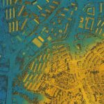
Modern GIS integrates geographic data, analytics, and visualization to reveal location-based linkages. Unlike traditional mapping systems, today’s GIS platforms incorporate:
This multi-layered approach converts geographic information into actionable operational insights, making GIS a core decision-support technology.
Artificial Intelligence (AI) and Machine Learning (ML) are redefining GIS capabilities. In 2026, AI-driven GIS systems can:
GIS is shifting from descriptive mapping to predictive modeling, helping organizations anticipate challenges and make proactive decisions.
The rise of connected infrastructure is fueling real-time GIS adoption. Sensors in cities, transport systems, telecom equipment, and power networks continuously send live data to GIS platforms.
This enables:
• Live traffic and mobility management
• Real-time monitoring of infrastructure health
• Immediate disaster and emergency response mapping
• Smart city operational control
Real-time GIS reduces response time and enhances system reliability, a critical need in modern infrastructure management.
Two-dimensional mapping is no longer sufficient for complex engineering. 3D GIS and Digital Twin technology now allow planners to create virtual replicas of real-world environments.
These digital twins support:
• Simulation of construction and infrastructure projects
• Environmental and structural impact analysis
• Precision planning for telecom and transport networks
• Scenario testing before implementation
This reduces risk, improves accuracy, and enhances long-term infrastructure performance.
Cloud computing has transformed GIS accessibility and scalability. Cloud-based GIS platforms provide:
• High-speed processing of large geospatial datasets
• Seamless collaboration among distributed teams
• Scalable storage and computing resources
• Secure centralized data management
Cloud GIS is especially valuable for large infrastructure and telecom projects involving multiple stakeholders.
Accurate GIS depends on high-quality data. Modern drones and satellites deliver near real-time, high-resolution imagery, enabling:
• Infrastructure inspection and asset monitoring
• Land surveying and site analysis
• Construction progress tracking
• Environmental change detection
Frequent data updates ensure GIS models remain aligned with real-world conditions.
AR-enabled GIS tools are transforming field operations. Engineers can overlay digital network maps, underground utilities, or structural layouts onto physical environments.
This improves:
• Installation precision
• Field safety
• Deployment efficiency
AR bridges the gap between digital planning and on-site execution.
GIS plays a vital role in addressing environmental challenges. Organizations use GIS to:
• Map flood-prone and disaster-risk areas
• Monitor climate and land-use changes
• Plan renewable energy infrastructure
• Manage natural resource consumption
GIS-driven insights support resilient infrastructure and sustainable planning.
Modern GIS emphasizes intuitive visualization. Interactive dashboards, heatmaps, and simulations allow stakeholders to quickly understand complex spatial relationships, accelerating decision-making and project approvals.
You may also like: “GIS Technology for Effective Environmental Conservation”
The evolution of GIS represents a move toward intelligent spatial ecosystems. Organizations adopting these technologies gain:
• Greater planning accuracy
• Reduced infrastructure risk
• Faster decision-making cycles
• Improved asset lifecycle performance
GIS is now a competitive necessity across telecom, utilities, construction, and urban development sectors.
As we enter 2026, GIS mapping stands at the intersection of AI, cloud technology, IoT, and immersive 3D modeling. These innovations are transforming GIS into a predictive, real-time, and interactive platform that enables smarter infrastructure planning and resilient system design.
For companies involved in telecom and structural infrastructure, integrating advanced GIS capabilities with expert engineering support is crucial. ASE Structure Design leverages modern geospatial intelligence and infrastructure design expertise to deliver precise, reliable, and future-ready solutions that align with the evolving GIS-driven planning landscape.
Organizations that combine advanced GIS technologies with specialized structural design knowledge will lead the next generation of data-driven infrastructure development.
GIS (Geographic Information System) mapping is a technology used to collect, analyze, and visualize location-based data. In 2026, GIS has become essential for infrastructure planning, telecom network design, utilities, smart cities, and environmental management because it enables predictive and real-time decision-making.
Artificial Intelligence helps GIS systems analyze large geospatial datasets, detect land-use changes, predict infrastructure risks, optimize telecom tower placement, and automate spatial analysis for faster and more accurate planning.
Real-time GIS integrates live data from sensors, connected devices, and IoT systems to continuously update maps and analytics. It helps organizations monitor traffic, infrastructure health, utilities, and emergency situations instantly.
A digital twin is a virtual replica of physical infrastructure or environments. It allows organizations to simulate scenarios, test construction impacts, analyze structural performance, and improve infrastructure planning before implementation.
ASE Structure Design supports GIS-driven telecom and infrastructure projects through precise engineering, telecom structural design, geospatial planning support, and future-ready infrastructure solutions.
WhatsApp Us